Groundwater monitoring is an essential element in any environmental information system. Based upon validated groundwater monitoring data, information is derived on which decisions can be made.
The biggest risk of not knowing how much groundwater there is, is using up too much. Constant monitoring provides the data necessary to make groundwater use responsible and sustainable. In addition, it can serve as a guideline for the decision making process concerning spatial planning and climate change adaptation. As in all cases the rule applies; one measurement is no measurement.

Groundwater monitoring can be small, with just one well, or big, with a whole network of wells installed throughout a country. A monitoring well is generally equipped with either a water level logger or water quality probe to do the measurements, depending on the parameters that need to be measured. This could be water level and conductivity, for example, to record fluctuations in groundwater and salt intrusion. A modem can be added to the well to transfer the data from the sensors to an online environment, where the data can be reviewed and analyzed.
The continuous monitoring of groundwater helps to:
In all cases, constant groundwater monitoring is essential to maintain or improve our water quality and ensure a constant water quantity.

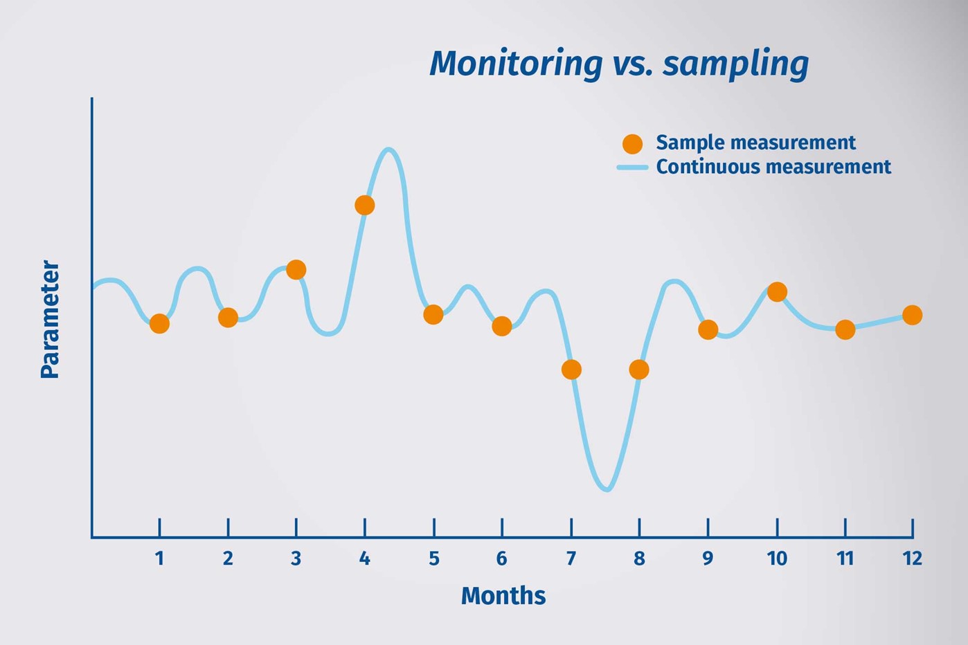
Alternatively, manual measurements can be taken regularly with a water level meter. But the main benefit of monitoring versus manual measurement is that the data collection is continuous: every small fluctuation or deviation is recorded, which can be important during sudden weather changes.
In addition, big changes can be detected immediately, so that any necessary actions can be taken in time.
By monitoring over time, trends can be detected and models created. These valuable insights are essential to start regulating usage of groundwater. If the effects of certain activities or weather circumstances are known, these can be taken into account when creating plans or measures.